


Land Surveying · Cadastre · Photogrammetry · Construction Surveying
Land surveying and cadastre office in Timișoara
Map Design is an ANCPI-authorized land surveying and cadastre office in Timișoara, founded in 2005. Every job starts with the documents in the land registry in Romania and continues in the field: topographic surveys for design, setting out of buildings, roads and solar parks, cadastre and land book registration – for large projects and small ones alike, with no need for you to travel. The quote arrives within 24 hours, in your language.
Send us a description, a document and the location — we reply within 24 hours.
Have a question? Call us directly.
Martir Sebastian Iordan nr. 1, ap. 4, Timișoara, Timiș, 300049
Land surveying and cadastre in Timișoara: what we do

Design and permitting
The topographic plan is the basis of any project. It shows the marking of property boundaries, elevations, site characteristics, utility networks, buildings and other necessary details, from initial design to the as-built survey. It is delivered in CAD and PDF format.

Buying, selling, registration in the land book
Cadastral documentation correlates the information obtained from measurements with the ownership documents, and the result is reflected in the land book (Carte Funciară): first registration, land subdivision, land merger, data update, error correction. We follow the work through to its acceptance by OCPI.

On-site execution
On site, compliance with the project is checked at each execution stage: the building footprint is set out, the excavation area is marked, the axes are set out, and the levels from ±0.00 are transferred to each floor, while horizontal and vertical control continues until the end of construction.

Large areas and infrastructure
A drone flight covers large areas in a short time. The images produce orthophotos, 3D models and topographic plans for design, urban planning, land monitoring and cadastre. The resolution is chosen according to the design requirements and the purpose of the work.
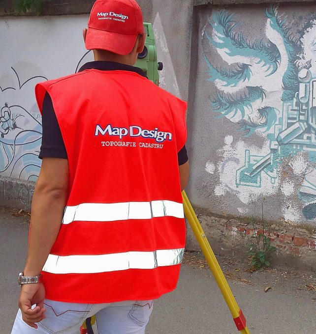

We take accurate measurements and prepare correct documentation, from a single parcel to a historic monument, with the same care in the field and in the office.
Who we are and how we work
We have been doing land surveying and cadastre since 2005, in Timișoara and across the country. We want every job to come out right the first time: redoing documentation means lost time for everyone. We have surveyed houses and halls, churches, fortresses and museums, electrical substations, photovoltaic parks and land for zoning plans (PUZ/PUD). Heritage work is as close to us as industrial and infrastructure work. We work best with people who want to express something through what they build. We are ANCPI-authorized and ISO 9001, 14001 and 45001 certified; the company and the drone pilot are certified by the Romanian Civil Aeronautical Authority (AACR).
Accurate Surveying and Cadastral Services
We always measure something beyond the requirements: as a verification element, and so that details missing from the design brief are not missing from the plan.
Attention to detail
The same attention goes to price: a balanced ratio between the value of the work and what the client receives.
Documentation, measurement and data processing are linked in a single workflow, from the land book extract to the plan delivered to the client.
Modern technology, time saved
Every job starts with documentation: the land book, archive plans and eTerra data. Only then do the field measurements follow.
 The collected data goes straight into TopoTanc, the land surveying and cadastre application developed in-house, which links the field, the office and the cadastre office in a single workflow. As a result, documentation is prepared faster, with fewer stages where errors can appear, and the client is kept informed throughout the job.
Measurements are made with a Leica total station and digital level, Meridian and South GNSS receivers and a DJI Mavic drone, at centimetre precision, and at millimetre precision where a technical situation requires it. Coordinates come in the Romanian national system (Stereo 70) and can be transformed into any projection system.
Services for designers, developers, contractors and owners
We carry out the work from the documentation and field measurement phase through to its approval by OCPI and the final documentation handed over, for individuals and companies in Timișoara, Timiș County and across the country.
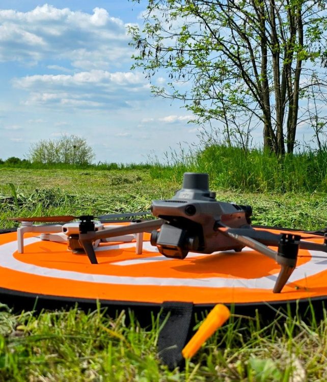
The flight resolution is chosen according to the purpose of the work, from orthophotos for urban planning to 3D models for monuments and buildings.
Speed and precision, from the air
Aerial photography produces orthophotos, topographic maps and 3D models for large areas: parks, photovoltaic fields, industrial zones, urban planning.
Flights are made with a drone, with ground control points measured by GNSS. Photogrammetric processing delivers orthophotos georeferenced in the Stereographic 1970 system, digital terrain models, contour lines and volume calculations, integrated directly into topographic plans and cadastral documentation.
Examples: the park in the Triaj area, Reșița, and the wooden church in Sartăș, a historic monument in Alba County, surveyed for restoration.


Land registry in Romania and buying property: questions and answers
General information about land surveying and cadastre services
The land book extract shows the owner, the cadastral number, the area and any mortgages or other encumbrances. We obtain it, read it and compare it with the situation on the ground: the survey shows whether the fences, the buildings and the area match the documents. A difference is better found before signing at the notary.
No. We start with a first conversation, by phone or video call, about the property and what you want to do. Documents travel by email or WhatsApp; we tell you what we found and what is still needed. Where a signature is needed in Romania, a power of attorney is given at a notary or consulate and translated and legalized here. The survey is carried out without you, and the documentation comes back with a digital signature; paper originals by courier if needed.
The land book number or the address of the property, an identity document and the ownership documents you have (sale contract, certificate of inheritance). Scans by email or WhatsApp are enough to start; anything missing we find during the documentation stage.
Yes. We answer in English by phone and email, and you are informed at every step: what we found, what follows and what is still needed.
In the Romanian national system (Stereo 70), required for approvals and cadastre. On request, coordinates are transformed into any other projection system you need.
Usually within one to two days, depending on ongoing work; for urgent jobs, the same or the next day, by agreement.
By bank transfer, on the basis of a contract and an invoice, in lei or euro.
The price depends on the job: the location, the area, what is required and the deadline. The quote arrives within 24 hours, in your language, from the quote page.
If all documents are available, we prepare the cadastral documentation in less than a week from the date of the survey. Approval at OCPI follows, with deadlines that depend on the type of work and the chosen regime — normal or urgent.
The first document we read is the land book extract. To prepare the cadastral documentation we also need the owner’s identity document and, depending on the type of work, other documents, specified when the quote is prepared.
Map Design has its office in Timișoara. We carry out topographic surveys, cadastral documentation and photogrammetry in Timișoara and in all localities of Timiș County, and on large projects we work anywhere in the country. We are an ANCPI-authorized company.
The persons and companies authorized to carry out surveys and cadastral documentation are listed in the public register of OCPI Timiș. Map Design is an ANCPI-authorized company (authorization series RO-B-J no. 2643/2023), with its office in Timișoara, at Martir Sebastian Iordan nr. 1, ap. 4. Contact: +40 749 031 223 or the request form on the quote page; the quote arrives within 24 hours at most.
A cadastre office carries out the field measurements and prepares the cadastral documentation, signed by an ANCPI-authorized person: first registration, registration in the land book, land subdivisions, land mergers, updates in the land book. The documentation is submitted to OCPI, and the office follows it through to acceptance and registration in the land book. Map Design has worked this way since 2005, in Timișoara and throughout Timiș County.
OCPI approves and registers. The cadastral documentation is prepared by an ANCPI-authorized person — our company does the measurements and the paperwork, and the file then goes to OCPI.
OCPI Timiș is based in Timișoara, at str. Armoniei nr. 1C — this is where cadastral documentation is accepted and land book registrations are made. The documentation is prepared by an ANCPI-authorized person: we do the measurements and the paperwork, then the file goes to OCPI and we follow it through to acceptance.
Intabulat means registered in the land book. In legal terms, intabulation is the definitive registration of a right — such as the right of ownership — in the land book. A registered property has a cadastral number and a registered owner.
The transaction cannot be completed at the notary, because the property is not registered in the land book. A sale could only be made in an unofficial form — practically non-existent legally. The correct order: first the cadastral documentation and registration, then the sale.
A topographic plan is needed for any design or building permit. The topographic plan shows the real terrain — elevations, utility networks, neighbouring properties, buildings — and is the document the designer starts from.
Surveying support means having the surveyor on site for the whole duration of construction: we set out the work on the ground, carry out checks along the way, monitor verticality and deformations, and prepare the as-built survey at the end of the work.
A drone survey is suitable for large areas and for work that requires maps, orthophotos or 3D models: parks, photovoltaic fields, industrial zones, urban planning. A flight covers in hours what would take weeks on the ground.
Each company chooses its own tools. We work in TopoTanc — the land surveying and cadastre application built by us, for our own work: it produces the documentation and data processing, keeps a record of every job, and links the field, the office and the cadastre offices in a single workflow.
The location of the land, what is to be done there and the existing documents or plans are enough; the quote arrives within 24 hours. After the contract come the measurements and the handover of the documents. The request is sent from the quote page.
Map Design
Map Design provides land surveying, cadastral documentation and photogrammetry services for businesses, real estate agencies, and architecture and design offices working in territorial development, in the Timișoara metropolitan area and throughout Romania.