


Professional cadastre services for any property: land, building or apartment
Romanian land registry and cadastre services
The cadastre is Romania’s official record of properties, and the land registry (Carte Funciară) shows who owns them and with what rights. Map Design, a company in Timișoara authorized by ANCPI, the national cadastre agency, carries out the survey, prepares the cadastral documentation and follows it at OCPI, the county land registration office, until the property is registered.
Preparation takes a few days and OCPI approval up to one month; the quote arrives within 24 hours, in your language. We work across Romania, and there is no need to travel.
Before the quote we check the property documents, and the quote is based on them. If something is not in order, we explain to the owner the steps needed to bring the property into legal order, according to the owner’s purpose.
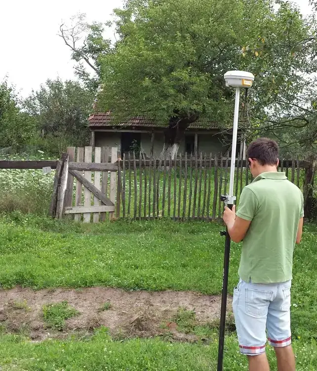
Cadastre and land registration services
The cadastre shows exactly what each owner holds: the location, the boundaries and the area of the property. Property tax is set on this basis, according to the type of land, and urban planning rules are applied to it; it also matters in every real estate transaction.
Converting a building into commercial or residential space, creating a residential or industrial area, updating ownership documents: for each of these, we prepare the cadastral documentation.
A correct cadastral documentation needs the relevant property documents. One of our specialists helps the owner identify, among the documentation types below, the right solution from a cadastral point of view:
Stages of a cadastral documentation
- First registration documentation in the integrated cadastre and land registry system
- Documentation for registering or removing buildings in the land registry
- Documentation for changing a property boundary
- Documentation for changing the area of a property
- Documentation for updating the use of a property
- Documentation for updating land use categories
- Documentation for repositioning a property
- Documentation for registering rights separated from ownership, such as usufruct or building rights
- Documentation for updating property data in the integrated cadastre and land registry system
- Documentation for updating the data of individual units
- Documentation for locating a property recorded under another municipality
- Documentation for the first registration of individual units (apartments, non-residential units)
- Documentation for rebuilding a land book that was lost, destroyed or stolen
- Documentation for entering in the cadastral plan properties in the area of Decree-Law no. 115/1938
- Documentation for the approval and registration of buildings as future property
- Documentation for the approval and registration of completed individual homes
- Documentation for correcting a clerical error
- Documentation for noting possession
- Systematic and general cadastre services
*these are registered directly in the land registry, on the basis of the documents in the cadastral file
OCPI documentation with direct registration in the land registry
With a single application to OCPI, the cadastral documentation is approved and the property, or the change to it, is registered in the land registry in one step.
- Documentation for land subdivision
- Documentation for merging plots
- Documentation for dividing a building into apartments, or changing that division
- Documentation for splitting or merging individual units (apartments, non-residential units)
- Documentation for dividing a planned condominium into units before it is built
- Documentation for the approval of completed condominiums, with a proposed division into apartments
*the final entry in the land registry is made by a notary public, on the basis of the cadastral documentation (two-step procedure, ANCPI Order no. 600/2023, art. 26)
- Taking land out of agricultural use
- Documentation for obtaining the Prefect’s Order
- Out-of-court cadastral expert reports
*these reach the land registry after several administrative stages
- Technical approval for a building or demolition permit project
- Technical approval for a Zoning Plan or Detailed Plan project (PUZ / PUD)
- Technical approval for a General Urban Plan project (PUG)
- Documentation for assigning a cadastral number, without land registration
*these are technical documents that are not entered in the land registry
OCPI documentation with later registration or no registration
These documents support other acts and procedures: the deed signed at a notary, the prefect’s order, the approval for a zoning plan or the building permit.
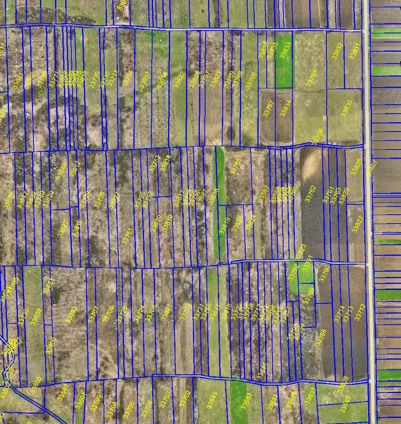

Why are cadastre services needed?
The cadastre protects a property in several ways. First, it confirms that the property on the ground is the same one shown in the land registry extract: the real boundaries and area are correctly registered, the owner is the legal one and the property has no defects. Second, administrative acts, building permits and other project documents rest on it.
Third, it supports a correct valuation for sale, rental or a loan. Fourth, it keeps the history: a subdivided plot shows which property it came from, and where ownership is unclear it can be traced who the parcel belonged to, as a starting point for a claim.
Map Design is authorized by ANCPI (authorization series RO-B-J no. 2643/2023) and has worked in surveying and cadastre since 2005, with ISO 9001, 14001 and 45001 certifications. The authorization is maintained with up-to-date training and equipment.
Frequent work: updating property data, dividing buildings into apartments, land subdivision, merging of plots, noting possession and others. An example from our work: cadastre and land registration for a residential complex in Timișoara; more in the portfolio.
Each quote is based on the specific work and can be requested on the quote page.
Accurate Surveying and Cadastral Services
We approach every project with a level of attention that goes beyond what our clients need.
Accessible and precise
We pay attention to details, including the cost of our services.
A good project starts with surveying, cadastre or photogrammetry done correctly

It produces a plan for design, also called a topographic plan: a graphic representation of the elements that delimit the property, including details such as elevations, utility networks, neighbouring properties and buildings.

A cadastral plan comes from a survey needed to establish the boundaries of a parcel using the ownership documents, which involves finding or establishing the corners of the property.

It is essential on any construction site: specialist support from surveyors in planning, carrying out and monitoring the works, ensuring the accuracy and quality of construction.

Images from the drone flight are then processed and analysed to generate topographic maps, 3D models and geospatial data, essential in construction, urban planning, land monitoring and cadastre.
Cadastre for owners, designers and developers
The cadastre comes before the project and after it: from land for a zoning plan (PUZ) or a building permit to the registration and division into apartments of a residential complex, for individuals and companies in Timișoara, Timiș County and across Romania.
Land registry: questions and answers
General information about the cadastre
The cadastre is an information system with data about properties and their characteristics: location, boundaries, area, buildings. In Romania it works together with the land registry, in a single national system.
- Land registry (Carte Funciară): the public register of properties, showing the owner, cadastral number, area, mortgages and other encumbrances. Each property has its own entry, called a land book, with its own number.
- Land registry extract (extras de carte funciară): the document that shows this entry, also called a land book extract.
- ANCPI: the National Agency for Cadastre and Land Registration, which authorizes the persons and companies doing this work.
- OCPI: the Office of Cadastre and Land Registration of each county, which approves the documentation and makes the entries.
- eTerra: the online system of ANCPI, through which we check the data and file the documentation.
Cadastral work may be carried out by persons and companies in Romania authorized by ANCPI to carry out and check cadastre, geodesy and cartography work and documentation.
As soon as possible, if the cadastral status of the property is not up to date. Cadastral law protects the owner and the property, while outdated documents often rest on old measurements, made with less precise equipment, and may contain incorrect entries.
For any cadastral work, two documents are basic:
- the ownership document: sale contract, donation contract, certificate of inheritance, court decision or property title;
- the identity document of the owner.
The other documents depend on the work. A tax certificate (certificat fiscal) from the town hall is required when registering a building in the land registry, when registering a house or block built as future property, after completion, when rebuilding a lost land book and, in the cases provided by law, at the first registration of a property. For a new building, the town hall’s certificate confirming that the building has been completed is also required.
We check the land registry extract and the status in eTerra, and we fill in the application to OCPI; the owner only signs it. Scans by email or WhatsApp are enough to start; the full list for each type of work comes with the quote.
Source: ANCPI Director General’s Order no. 600/2023 (Regulation on approval and registration in the cadastre and land registry records), art. 72, 87, 114 and 240, as amended by ANCPI Order no. 293/2026 (art. 2439–24310), in force since 8 March 2026.
The cadastre is the whole system that keeps track of properties: where each one is and what boundaries, area and buildings it has. Land registration (intabulare, in Romanian documents) is the entry of the right of ownership in this record, in the land registry. For a data update, a first registration or the noting of possession, the entry in the land registry is made directly, on the basis of the cadastral file.
For a land subdivision, a merger of plots or a division into apartments, the cadastral documentation is our part, and the final entry is made through a notary public. The same applies to a right of superficies, usufruct or easement on part of a plot: the cadastral documentation identifies that part, and the notary draws up the deed.
Source: Law no. 7/1996 on cadastre and real estate publicity, republished; ANCPI Order no. 600/2023, as amended by ANCPI Order no. 293/2026.
No. Registering the right of ownership requires an ownership document in the form provided by law. Without documents, in the cases provided by law, the possession can be noted in the land registry, on the basis of a cadastral documentation; the right of ownership is registered later, when the proof exists.
Source: Law no. 7/1996, art. 41; ANCPI Order no. 600/2023, art. 119.
The documentation is finished after the OCPI approval. The updated land registry extract, the cadastral documentation and the site and boundary plan of the property (plan de amplasament și delimitare, PAD) are handed over. For a land subdivision, a merger of plots or a division into apartments, the updated extract comes after the notarial deed.
Yes. Where a signature is needed in Romania, a power of attorney is given at a notary or consulate and translated and legalized here. Documents travel by email or WhatsApp, and the survey is carried out without the owner present. The documentation comes back with a digital signature; paper originals by courier if needed.
Map Design
Map Design provides land surveying, cadastral documentation and photogrammetry services for businesses, real estate agencies, and architecture and design offices working in territorial development, in the Timișoara metropolitan area and throughout Romania.